
Locating and mapping underground utilities is an essential task for anyone working in the construction industry. The process of tracing buried pipes, cables, conduits, and other infrastructure can be time-consuming and difficult to do without specialized tools.
This guide provides a comprehensive overview of how to accurately locate and map underground utilities so you can save time and money while ensuring safe excavation practices.
Purpose
The purpose of this guide is to provide information on how to locate underground utilities. This includes locating existing utility lines as well as potential new ones. It also outlines the methods used for mapping these underground features, such as surveying, aerial photography, ground penetrating radar (GPR), and other technologies.
Additionally, it explains when professional services are necessary to ensure accuracy and safety during a project.
Understanding the process of determining the exact location of an underground utility line is important before any construction or excavation can begin. Even if there are no plans or drawings available from the original builder, sophisticated tools can be employed to find them quickly and accurately.
As part of the preparation for a project that requires excavation near buried utilities, research should be conducted into the type and age of infrastructure present in order to determine what kind of equipment will need to be utilized for accurate mapping.
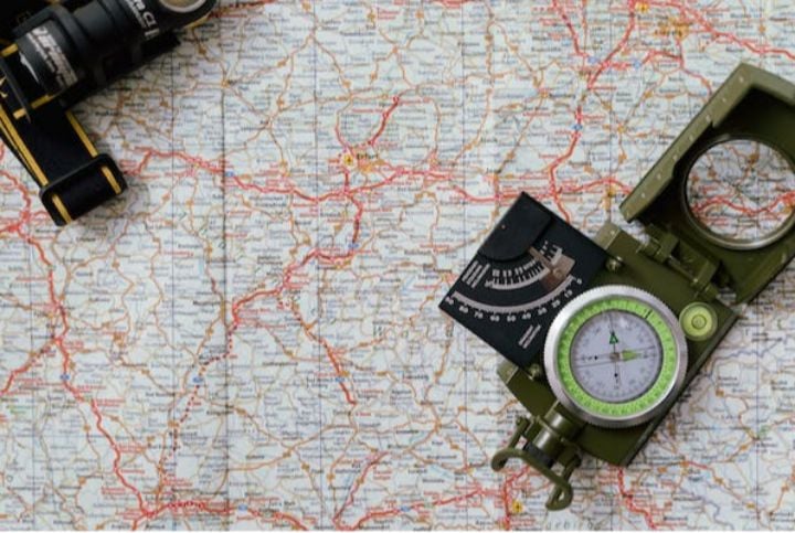
Mapping And Locating Equipment
Mapping and locating underground utilities requires specialized tools. This equipment can be used to map existing utilities, as well as detect any newly installed piping that may not have been recorded yet. This section will outline the types of equipment commonly used in utility mapping and locating.
The following are some of the most popular pieces of equipment used:
- Ground Penetrating Radar (GPR): A GPR sends out electromagnetic pulses into the ground, which allow users to get an idea of the subsurface layout without digging or drilling.
- Electromagnetic Locators: These devices use a transmitter to send out an electrical current and then measure for changes in frequency or field strength when coming close to an object that could be a pipe or cable.
- Radio Frequency Identification (RFID) tags: RFID tags contain microchips with data about the location of pipes and other objects buried beneath the surface. They can also be tracked remotely using receivers placed at various locations along their route.
Utility mapping and locating are essential for many industries, from construction to engineering, gas companies, water departments, etc.
Without proper knowledge and vigilance on how these underground utilities should be mapped and located, it can lead to costly damages due to accidental excavation activities.
It’s important to understand what type of equipment is needed so work can be done safely while avoiding disruption caused by accidentally hitting lines during projects.
How To Identify Underground Cables And Pipes
Identifying underground cables and pipes can be as difficult as finding a needle in a haystack. Fortunately, several methods can make the process easier.
The easiest method for locating utilities is to use an electronic locator device. This device emits electromagnetic signals that allow you to trace cables or pipes below the surface of the ground.
The depth of the utilities will also be displayed on the screen of the device, so it’s easy to locate them without having to dig up large areas of land.
Another option is to contact utility companies whose lines may have been installed in your area. They should be able to provide detailed maps showing exactly where their lines are located beneath the surface. Once you know these locations, it’s much simpler to determine what other types of utilities might exist in those same places.
Additionally, many cities have aerial photographs available online, which can help pinpoint exact locations of buried infrastructure with great accuracy.
By using one or more of these methods, anyone can easily find and map out underground utilities with relative ease. Knowing what lies underneath can save time, money, and effort when planning projects involving digging into soil or excavating land for construction purposes.
Safety Precautions
Safety is paramount when locating and mapping underground utilities. It’s important to always wear the proper protective gear, such as hard hats and high-visibility vests.
Additionally, it’s a good idea to carry a first aid kit with you at all times in case of any potential injuries or accidents.
It’s also critical that one familiarize themselves with local safety laws and regulations before starting work on mapping out utilities.
Pay attention to where utility lines are located, what type they may be carrying, and whether there could be pressure involved in the transmission of electricity or gas. If unsure, contact the appropriate authorities for further guidance.

Furthermore, only use specialized equipment designed for this purpose; never attempt to locate underground utilities without tools specifically made for that job.
All workers should read and understand instructions for each piece of machinery prior to using it so they can operate safely and effectively.
Remember: When it comes to safety precautions when working with or around underground utilities, better safe than sorry!
Regulations And Guidelines
Before beginning any project involving underground utilities, it is essential to understand the relevant regulations and guidelines.
First, federal and state governments have specific laws that must be adhered to for a project to proceed legally.
Second, utility companies provide their own set of guidelines related to working around or near existing infrastructure.
Lastly, industry standards should also be consulted as they can offer best practices on safety protocols when dealing with underground utilities.
It is important for those involved in locating and mapping these utilities to familiarize themselves with all applicable laws, company rules, and general safety information before starting a job site.
Doing so will help ensure compliance with local regulations and reduce potential hazards during the process.
Conclusion
The process of locating and mapping underground utilities can be daunting, but with the right knowledge, it doesn’t have to be. Understanding how to use the proper equipment, identifying cables and pipes safely, and being familiar with regulations will ensure that you can do so efficiently and accurately.
It’s important to take safety very seriously when doing this kind of work. Make sure all protective measures are taken before proceeding, as failure to do so could result in serious accidents or injury. Remember: safety first!
Ultimately, if done correctly, locating and mapping underground utilities can be a rewarding experience. I hope this guide has helped equip you with the skills and know-how needed for success – now go out there and map away!
We hope you found this blog post on Guide to Locating and Mapping Underground Utilities useful. Be sure to check out our post on How to Unclog Underground Drain Pipes? for more great tips!

Have Experience in the Moving Industry? Want an Additional Income Stream? Work With All Around Moving!
Relocation and Moving Consultant: Join the Work With Us program! We provide you with the carriers, or you can use your own carriers, and by joining, you could have your own company up and running very fast.
Click here to learn more and how a nominal one-time start-up fee gives you the “key” to having your business.